|
| rigging at Lee's Ferry |
Back from our river trip. Going at all was up in the air because Brad needed a substitute who could teach math. Turns out there are NO substitute math teachers available in the entire state. Maybe because people who are good at math and science get real jobs. Finally Renta's brother came to the rescue. He makes more in 10 hours of computer programming than he got for three weeks subbing, but he enjoyed working with the kids and taking hundreds of pictures of the Canyon. I didn't realize my math certification was such a valuable commodity.
Twenty one day trip, and these were the campsites:
Soap creek, Oct 14. We did not realize fully that the wet sand where we unloaded meant the river would rise that high overnight. Flooded the kitchen, but nothing floated away. A commercial group passing yelled, "Do you know where you are?" Might have been trying to warn us, might have been ticked because they wanted that site. No help in either case.
21.5 Mile: Oct 15
 |
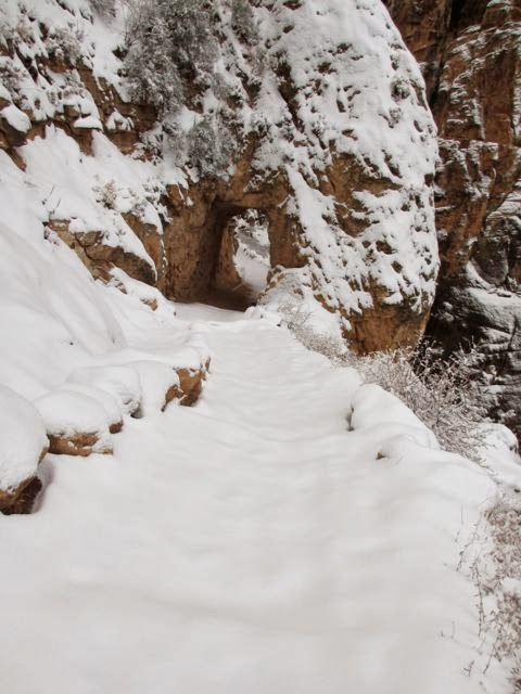
| Hike up Buck Farm |
Nankoweap: Oct 16. Hiked up to the site. I kind of agree with Bob Leighty that these don't look like granaries. The doors are wrong. Granaries have a specific type of doorway and lintel, also hooks of willow to fasten the door into place. As to what they really are, couldn't say.
Lava Canyon: Oct 17. HIke up Chuar and down Lava, which I have wanted to do for a long time. Fantastic geology along the Butte Thrust Fault. Randy slipped on a rock by the River and his leg swelled up twice its size. Dr. Jane and EMT Karen splinted him up and we BEAMed him over to a copter landing site. He was evaced in the morning. Turns out it was not a break, but a compartment injury. In any case, he wasn't walking out on his own. The rescuers were most impressed that the victim was packed and ready to load.
 |
| BEAMing victim to the landing zone |
 |
| Randy gets a fast trip out |
We hit the LCR that day, and it was in flood. So much for our clear, green water. Had to settle all water overnight before purifying after that.
Nevill's Rapid: Oct 18. I have always wanted to camp on this lovely beach. Have walked through it many times on the Escalante route.
Cremation: Oct 19: Shared camp with another group, as is usual when groups are doing passenger swaps. Dan took eight hikers to Phantom at 5 AM, headlamps blazing. It took them a while to figure out if they looked at Dan, he couldn't see to row, then they all aimed downstream. Quite a sight. Actually, some of them never did figure out that while wearing a headlamp, it is easy to "frog" the person who is being talked to.
Switched out riders at Phantom the next morning. Brought Karen a lemonade, since she was stuck on the beach organizing everyone. Loaded the passengers, hit Horn Creek, and Karen flipped. Jim hit a rock at the bottom of the rapid so hard he was thrown out of the boat. I yelled "swimmer!" (proper terminology. Brad's group yelled, "they're out" which he thought meant they were out of the rapid).
I slid back to grab the oars, but one was in the water and the other trapped underneath a poorly tied drybag. Since the oars are on a leash, one was easy. The other I was able to free enough to row forward and pick up Susan, who was swimming. Then she and I, with much blue language, managed to move the errant drybag and tie it out of the way. I rowed into an eddy, because I wasn't sure where Jim was, and I didn't want to head downstream if he was still in the water. The other three boats were around a cliff downstream. Much yelling ensued. We did have radios, but ours was dead because it had been submersed in a bucket of water for a week. They are waterproof, but not that waterproof. We were working out a plan to float down to Karen while still tied up to the eddy, so she could row the boat when Jim and Jerry appeared, crawling along the rocks. I rowed over and picked them up, and we joined the other boats.
Brad, Karen, Scott, and I had taken a river skills class in 2007, so we knew how to right a flipped boat. They roped up, walked across the bottom of the boat, and yanked it back upright in about five minutes. The last time we flipped, back in 1991, we didn't know that trick, and we had to unload the boat while it was underwater. Then a second group came through upside down, so we offered to unflip their boat. It took a bit longer, because they thought they were supposed to jump into the water instead of walking back along the bottom. Bill was in the flipped boat, and decried the loss of his sunglasses, which were, in fact, still hanging around his neck. Understandable.
Granite: Oct 20.
Emerald: Oct 21. A small, rocky camp, but everyone was tired and still freaked out from the flip. That night I slipped on a rock and sprained my ankle. When I fell, I woke up Ted: I told him that I sacrificed myself by throwing my body to the side so I wouldn't land on him, but truth be told, I would have landed on him anyway had he been in the wrong place. He and Paul wrapped the ankle and I soaked it in cold water. In the morning, Karen berated me for not waking her up. I told her I wasn't going to bother her for less than exposed bone. Much consternation because I broke my headlamp and everyone thought I was wearing it at the time, which should have meant a concussion. Nope, it was in my hand.
Lower Bass: Oct 22. Another lovely beach I had wanted to spend time at, but now that I was here I had that stupid sprained ankle and no one would let me walk anywhere, including to the groover. Others walked up to the top of the hill, and a few into Bass Camp. I sat under the trees, brooding.
There is a parable about a Rabbi who visits around. He goes to a poor man's house and is treated well, and when he leaves, the man's cow dies. He goes to a rich man's house and is treated badly, and when the Rabbi leaves he thanks the rich man lavishly and pays to repair a fallen wall. The Rabbi's companion asks where the justice in in that? The Rabbi answers that the poor man's daughter was due to die, and instead his cow was taken. The rich man would have found gold behind the ruined wall, so the Rabbi repaired it. I like to figure that I was supposed to have flipped in Horn, and instead I sprained my ankle.
Above Fossil: Oct 23. Stopped at Stone Creek, which I had always wanted to do as well. I grabbed a big stick and hobbled over to the waterfall. Deer Creek had no one there except a group of drunks who had camped across the river.
What a relief to get Bedrock over with. That is where I swam the left side in 2001. We always remember the rapid we swim.
Football Field: Oct 24. Hit Matkatamiba Canyon. I have in my notes to skip this, and I was right. Karen advised all and sundry to wear helmets, and Jim didn't and fell and cracked his head. I was plotting on how to get the boats through
sans one boatman. I figured we would have Scott row, pull over and walk back, and row again at each rapid. The doctors stitched Jim up with steri-strips and tagaderm, and pronounced him good, so we didn't have to resort to double running.
The scout at Upset Rapid was so long that I began to scare myself. I decided I was walking this one. I started downstream and met the boatmen, and told them I was chickening out. Karen said, "Good idea, in fact I think everyone should walk this one." So most of us walked, and some stood ready with throwbags. Scott went left, and had a good, wet run. Karen went right and did fine. Brad tried to go right, but got into the hole. He rocked around dramatically, but made it. Getting everyone back into the boats was more dangerous than the rapid.
Upper Ledges: Oct 25. Brad hates this camp. I like camping on the rocks OK, but I admit it is dangerous to get in and out of the boats here. One of our party would always wander off while the rest of us unloaded in order to find the best campsite, and this time the chosen site was where we wanted the groover. The only place, in fact, that would not involve a long hike across the rocks. This party argued mightily, but we said, Slim shouldn't be walking that far with her ankle, and Jim shouldn't be walking that far with his head, so the groover was put where we wanted.
Tuckup: Oct 26. We had planned a layover here. The climbers were going to put in a route so we could climb up into the upper canyon. They set out in the evening to check it out, and decided it was too risky. I admit I was just as glad, because I couldn't have done it with my ankle. Certain party had to move the campsite again, because it was right next to the groover.
Honga Springs: Oct 27. Nice little side canyon with water and an Agave Roasting pit. Had to chase another person out of the groover sight. When there is a trail leading off into nothingness, and it stops at a sheltered spot, it is usually a groover spot.
We seemed to have two schools of thought regarding groover placement. Some of us wanted privacy, some wanted convenience. At Emerald, the groover was right next to the kitchen. When it was pointed out to me, I said rather acerbically, "I know where it is: I can see it". They strung a tarp. If one has to hang a tarp for privacy, the groover is too close. I go for privacy, even if if means a bit longer walk. Or in my case, hobble. This site was considered a challenge to find in the dark, to which I say, I always locate the groover before it gets dark.
Ran Lava no problem. I was with Scott, and we went through first, thank goodness, I didn't have to contemplate the run. We turned backwards about halfway through, which was fine with me, because then I didn't have to see it, either. As Brad said, you commit and your decision has been made, all that's left is the ride. I was holding onto a strap which attached the frame to the boat, in retrospect a bad idea. I bruised one knuckle badly, and had the boat wrenched around much more, I could have trapped my hand.
Really love the basalt flows in this area. Query: for those who believe that the Earth is 6,000 years old, and the Canyon was formed by Noah's flood, where did the basalt come from?
Whitmore Wash: Oct 28 and 29. A layover day for hiking. My ankle was good enough (I told it sternly) that I could walk with an aggressive ankle brace (thanks, Karen!) and hiking sticks (thanks Karen and Paul!) The first afternoon some us us climbed up a "stock trail" above camp. If stock went up that trail, I want to see that stock. Saw our first rattler. The next day we hiked to the Pictographs, and some of us continued up to the rim. Another rattler. When we got back, I changed shoes and walked down to the River. I flipped my skirt out of the way, and a scorpion went flying off. Hmm, wonder how long he was on there? Probably climbed on when I sat down to change footwear. It wasn't
centroides, so it wouldn't have been a bad sting, but it could have been an embarrassing sting.
Parashant. Oct. 30. Hiked about three miles up the canyon. Found lots of lots of cool fossils, including a crinoid head. Very rare. In the morning (Halloween) I planted fluorescent plastic spiders around camp, including several in my hair. Arachnia, queen of the spider people.
Granite Park Cap: Oct 31. Hot and boring. We were supposed to hike here, but the streambed was open, hot, and not interesting, and the "crack" climb the climbers were excited about was too far away and too hot. Not worth it. Paul and Melody had brought costumes, and gave us trick or treat. Someone asked, "Did you plan that?" Why, no, they found the costumes under a tree.
That evening I was sitting up late (8:30!) with some folks, and we wondered how much butter and cream cheese we had been given. We seemed to have a lot. I got the supply book, and we had been given 16 pounds of each.
I started reading the list. One of the problems with this trip, particularly during the first week, was no one could find the food when they were on kitchen duty. So some things were substituted (OK), and some were just left out. Not so OK, when it meant a skimpy lunch or dinner. Certain parties didn't try very hard to find anything, either. If it didn't jump into their hand, they skipped it. There was a lot of "Oh, no, that's not on MY boat". Even when it was.
I saw in the list that we had frozen fruit, so I dug that out for breakfast in the morning. We had four boxes of Nutter Butters. "What?" I said, "All we get are stupid Chips Ahoy, I haven't seen any Nutter Butters!" Ted said, "Oh, there are some in the lunch box", so I fetched them and we ate about half of them. Ted complained loudly that he only got one, and I told him to shush: he was a lousy conspirator. When lunch came around the next day, no one said a thing.
Ran into another group when we stopped to hike. They invited us to a Halloween party at 220 along with another group we had been passing so they could "use up all their booze". Fortunately, we still had an extra day, so we begged off.
I waited seven years for this permit, and I assume the other groups waited about that long. So why get so wasted that you don't even know where you are? That can be done at home on the couch.
Nasty headwind getting into camp: the first we had to fight. Brad was rowing and going nowhere. In the afternoon, we saw what looked like a bag of garbage floating, and I thought: flipped boat. But it was two people with river boards. Kathy says these are new, and they use them in Buena Vista in the play waves. Looks cold to me. They had a paddle boat, an oar boat, and a dory in support. Brad thinks it was AZRA guides on an end-of-the-year jaunt.
Mile 200: Nov 1. Hiked up to the mosaic rock, and then to a chockstone. The mosaic is wonderful. A mastic filled with all the rocks of the Canyon, and polished to a sheen. Wayne Ranney tells me that in the Ice Age, the groundwater was much higher in calcium, which would have formed the mastic. Then a permanent stream sometime in the past would have polished it.
Nov. 2 we took out at Diamond Creek. Just beat AZRA so they had to unload in the mud.
I was scared for most of the trip, until Lava Falls, actually. I agree with Dan, that a river with class two rapids would be about right.
My flip in Bedrock in 2007, made a believer out of me. Then when the boat flipped in Horn, all the passengers were caught under the boat, which gave me nightmares, and I wasn't even in the flipped boat. I like the camping, and I like hiking into areas which are difficult to get to otherwise, but I don't like the big rapids. Most everyone else treats it like a Disney ride, but those of us who have swum know better. I confess at times I wished some of the Disney people would be thrown out of the boat. Not flipped: I don't wish that on anyone. Just a little adventure swim.
We had our trip outfitted by PRO, and they did a sterling job. Last time the menu was very elaborate, and we spent a lot of time in the kitchen. This time we had the "quick and easy" menu, and it was just right. Heavy on meat, butter, and cream cheese, but otherwise fine. I wonder if they sent so much of those because we were edging into winter and we might need the extra calories.
Three meals had beans: bad idea when 16 people are using the same groover. We skipped those meals. We had enough leftover meat that we could switch around and still have lots to eat without the beans. Had lots of canned food left. The cans were designed for the last week, but our ice lasted the whole time, so we could use the leftover meat.
All of us on the trip were set back to zero for the permit lottery, and we missed the entry date this year. We were on the River! But we'll all put in again for a permit in February. I lost one river knife and one swiss army knife, probably from the pocket in my life jacket. I suppose they were worthy sacrifices.
 |
| The whole Motely Crew at Mile 220 |
 |
| Brad and me, with crutch, at Stone Creek. |