Sunday, February 16, 2014

How many times have we hiked the Dripping Springs Trail?  Must be over a hundred.  And how many times have we walked past these cool footprints?  Oh, about a hundred.

One of the teachers at school said she saw "hand prints" on the trail.  We scoffed.  Must have been some sponge fossils.  But nothing loath, we headed out for Columbus Point today, and by gosh, there are huge prints, and they do look like hands.
Up the rock he goes.

They are, of course, a mammal-like reptile that was crawling across the sand dunes which would later make up the Coconino Sandstone, but they do look like as though someone walked up the rock on his/her hands.  There were, in fact, three pairs of tracks heading up this rock.  None coming back.  Maybe they got et.

Decided we needed a long hike today, so we did thirteen and a half miles to Columbus Point and back.  Not as much elevation change as our normal long hike to Panorama Point, but rougher.  The Boucher, in fact, is extremely rough.  At one point, Brad told me to wait up, and I was in a most precarious position, and my thought was, "got to be kidding".

Saw two backpackers coming in with no permits.  Then two ladies coming down asked us where Dripping Springs was.  Brad pointed and they disagreed,  "No, it is only two and a half miles to Dripping Springs".

"It is three miles."

"I'm not talking about Santa Maria."

"Neither am I, and we just came from Dripping Springs."

"Well, why aren't we there yet?"

"Probably because you have only walked about one mile."

Why do people ask if they are going to say, "No, that's not right".  If they know that, why do they ask?


Friday, February 14, 2014

525 million year old Tapeats sand over and around  one billion year old quartzite
Taking geology classes gives one a whole new perspective on the landscape.  One begins to notice offsetting by faults, or intrusions.  On the South Kaibab I have walked past this rock hundreds of times.  Last weekend it was featured in a lecture about the Grand Canyon Supergroup, and I sat down and had lunch here today.

One billion years ago, the Shinumo Quartzite (or more accurately, the Shinumo meta-sandstone, see below) formed a cluster of islands in an advancing sea.  The Cambrian Sea, for such it was, surrounded these islands, often knocking pieces of Shinumo off the cliff and into the sea sand beneath.  Think the sea stacks on the Oregon Coast.

The Olympic Peninsula
 
As the trail winds down through the Supergroup on South Kaibab, one can see boulders of Tapeats with huge hunks of Shinumo lodged in the sandstone.  It almost looks as though they could be picked up and moved, but of course, they are part of the rock matrix.

Shinumo rocks which were knocked loose by wave action and stuck in beach sand.
This section of trail follows a block of Supergroup which was faulted down during the breakup of the continent of Rhodenia.  I am outlining a talk I will give in April about the history of geologists at the Grand Canyon.  While I was researching it occurred to me that the geologists who came out west: Newberry and Powell and Blackwelder, had studied geology in Europe or back east.  They had never seen rivers that could cut through mountains and plateaus.  They had never seen rocks that folded and bent in the scale seen around Mexican Hat.  This was a completely new paradigm for them.  A few of them suggested that the land had uplifted, but this was before plate tectonics, so all they could imagine was the land moving up and down via volcanic action.  This must have totally blown their minds.

Bill Nye says that when scientists find something they cannot explain, this is great!  This is how science and knowledge advance.  When new information becomes available, science incorporates it to explain old ideas.  When plate tectonics was first suggested, everyone said, great idea, but what is the mechanism?  Then during deep water exploration in the 1960's, scientists discovered lava pouring out in deep ocean trenches, pumping out acres of basalt which are pushing the oceanic plates apart.  Ah ha!  Here is the mechanism!  And tectonics were used to explain heretofore unexplained phenomena.

I have an old science book with a map of the world superimposed with dinosaur icons.  Since the same types of dinosaur fossils are found on different continents, this book explained,  the climate was the same sixty five million years ago in these disparate areas.  Well, it was, but because it was all one continent.

There is a lot I don't know about geology.  Of course, I know extremely educated geologists who, when I ask a question, will still say,"well, I'm not sure about that one."  Wayne Ranney says that one geologist is a blessing: two is an argument.

I once asked why a metamorphic rock (Shinumo Quartzite) can be layered between two sedimentary rocks (Dox Sandstone and Hakatai Shale) and was told that the sophistication of my question indicated my progress in understanding geology.  Wow!

The answer is that all the Supergroup was buried long enough that every layer underwent a bit of metamorphism.  And the layers should actually be described as meta-sandstone, meta-shale, etc.  But since most people are still at the Deposition Uplift Downcut Erosion level of geology, the interpretive signs won't change anytime soon.


Monday, February 10, 2014

Part of being a good educator is being a lifelong learner.

So many teachers I know have their set way of teaching their set classes, and under no circumstances will they change.  "I've been teaching for twenty years, so don't tell me..."  Marzano does empirical research on teaching, and his book is called "the art and science of teaching".  A lot of teachers hate this.  They tell me that teaching is an art.  That may be so, but learning is a science.

So back to life-long learning. I had, of course, known the formations of the Grand Canyon for a long time.  A formation being an identifiable section of rock which can be described scientifically and is distinctive in appearance.

I was leading a rim to rim hike, secure in the knowledge that we were in the Redwall Limestone, and it was 325 million years old.  A woman on the trip, who obviously knew more geology than I, commented, "Surely we are coming to the Ordovician soon".  If you say so.

Just then we fortuitously ran into a sign which stated that the Ordovician and the Silurian do not present within the Grand Canyon.  With great relief I referred to the sign and said with authority, "Afraid not, because they have either eroded away or they were never deposited."  Whew.

However, I did think: if I am going to keep doing this, I had better start taking geology.

I have to date taken 9 credit hours in Geology of the Grand Canyon and 6 in general geology.  Having this scaffolding, as we say in education, has helped immensely when I attend training for Grand Canyon guides.  When Christa Sadler gives us her version of how the Colorado River cut through the plateau and talks about the Mogollon Highlands, and the Sevier Highlands, and the Basin and Range Disturbance, it is like meeting old friends.  Yes, Yes, I know of what she speaks!

So I pass on this learning to my classes in the Canyon.  And they are are duly impressed.  Often they are overwhelmed, not having the advantage of 15 hours of college level scaffolding.  It was, in fact, suggested to me by a peer that I should restrict myself to one new term a day.

That's a toughie.  Especially when I am asked questions.  "What exactly is a nonconformity?"  "I'm sorry, I've hit my quota for new terms for the day".

One of my best friends teaches at the University level, and I asked him about this.  He said that he thinks of learning as sitting in the breeze from a fan.  You may not get all of the moving air, but you get as much as you can use.

And then sometimes I get people who are Interested.  They take in what I say, and they ask for more. And sometimes I can't answer their questions.  So I have to do some reading. Or ask someone who knows more than I.  Or take another class. And so it goes.

But I was at a ranger program this year, and one of the attendees asked the ranger why there is so much uranium in the area.  She didn't know, so I raised my hand.

"Breccia pipes," I said.  Blank looks.  "The Redwall Limestone was exposed at the surface for a long time, and being limestone, it developed a karst landscape.  One it was buried under subsequent formations, the caves sometimes collapsed, forming breccia pipes.  These pipes fill with rock debris, called breccia, and hot water from beneath the earth ascends due to capillary action, carrying heavy minerals within.  These minerals tend to congregate within the breccia pipes, and that is where they find uranium."

The ranger was happy.  The questioner was happy. I was happy. Lifelong learning.  I recommend it.
Breccia pipe in Supai


Friday, February 7, 2014

Our science teacher at the school is determined that students at Grand Canyon High School will by gosh learn about Grand Canyon.  She dragged her Environmental Science class down to Indian Garden last night. In the dark.  In the snow.  On the ice.  And shanghaied me to hike down and give a lesson on geology.

Hike to Indian Garden on a lovely winter day?  Twist my arm.

Started out bright and early and there was untrammeled snow on the Bright Angel Trail. I was breaking trail in new snow.  On the Bright Angel.  On THE most traveled trail in the Canyon.  Wow.

Unbroken snow at lower tunnel.  OMG
Didn't see another person until just before Indian Garden.  I told them they should have hidden so I could break my record of no one until IG, but that just got me One Of Those Looks.

I have told several people that they were the first I've met on the trail all day, and they rush to assure me that "there are a lot of people behind me".  I guess they think that I am worried about being alone on the trail, when in fact I am reveling in the idea.

So met the class, gave my standard "four reasons the Grand Canyon is here and nowhere else on earth" and hiked down to the Great Unconformity with them.  Gave my GU talk, and hiked to the stop of the Devil's Corkscrew. Then we had to, alas, hike back out.  I have meetings all day on the rim tomorrow.  Twelve miles RT and 3,500 feet, not counting the walk to the rim and back from the apartment.

Then I passed some kids who mentioned something about "bringing out the competitive nature" in them, so I had to beat them out.  Came out from Indian Garden in under two hours.  Show off.  I justified it by telling myself that I needed a long interval workout because I'll be sitting on my butt for the next two days in meetings.  It had nothing to do with beating three kids a third my age out of the Ditch.

Right.

Sunday, February 2, 2014

One of the perks of working in a National Park is that I get to drive onto closed roads.

Not all of them.  I know the combination to get into the Shoshone Point road, but I am not allowed to use it.  Either this indicates that they trust me, or that they are messing with me.

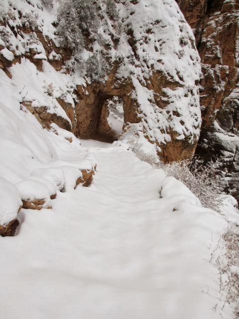
In any case, I know the code for the West Rim Drive, and I can legally drive around the barrier to the South Kaibab Trailhead.  Parking for the SK is really limited, so it used to be open for public parking only during the winter.  Then the powers-that-be noticed that when the trailhead was so open, the search and rescue calls more than doubled.  I suppose if a hapless hiker wanders down the Bright Angel Trail, there is water, and emergency phones, and often a Ranger or two.  If one haplessly wanders down the SK, there is no water, one emergency phone four and a half miles down, and usually no Rangers.  Just other hapless hikers.  So they closed it all year. Except for those of us who live and work in the Park.  Hoping against hope that if someone has to be organized enough to take a shuttle bus to a trailhead, they are organized enough to carry a few frivolous items like water, food, and a flashlight.

The problem is, if I scoot around the barrier, someone often follows me.  The barrier is just a gate that closes off half the road.  Shuttle busses tootle in and out of this road all the time, and there is no power source for a number pad control for a gate.

So one drives onto the wrong side of the road to get around a gate which has a sign proclaiming that this road is indeed closed to traffic, that only residents and official vehicles are allowed therein, and please take the free shuttle bus.  Most people turn around.  Some don't.  Several follow me.

So what exactly is the reasoning here?  If she is breaking the law, so can I? They'll ticket her first, and while they are writing the citation, I'll get away?  There is safety in numbers, and they can't catch us all?

I've tried that last one before while waiting for the dining hall to open at Phantom Ranch.  I say, "There are forty of us and only one of her.  She can't stop us all!"  No one ever takes me up on it.

I tell people who do follow me that unless they have a sticker like this one (pointing at my visual aid), they are not allowed to park here.  "Oh," they usually answer.  "I didn't see a sign."  No, you just drove around a barrier.

Often the hikers who took the shuttle in give me a dirty look.  Sometimes they will walk over and say, "I didn't think you were allowed to drive in here," at which point I answer, "Well, you aren't.  But I am."  Then I show them the stickers on the windshields of the Phantom workers who park there, and the Rangers who park there.  Once an educator, always an educator.

Some of the Rangers make a point of putting a warning sticker on illegal cars.  It is just a warning: they don't have the personnel to ticket and fine people.  Though I think it would pay for itself.  Back in the day, cars were towed.  When one obtained a backcountry permit, they wrote down the licence plate.  If the plate at the trailhead was not on the permit, and was there overnight, it was towed.  After one of the periodic rock slides on the Grandview Trail, it was closed for repairs.  My college roommate zipped up there to hike in illegally, and when she came out, surprise!  Her car had been towed.  Really, what did she expect?

When I have extra time and am in the mood, I put my own warning tags on cars.  They are printed on bright pink paper, so they look official, and say, "There is no parking at this trailhead.  Please take the shuttle bus, or park at Pipe Creek Overlook".  I hope it gives them a jolt when they see the colored tag, but I know it does no good.  It makes me feel a little better, though, so I suppose it is worth it.  We don't have television up here, after all.  We have to entertain ourselves somehow.
Abandon all hope, Rraawk!